+ 30
programmers and analysts
24/7 Support
always in touch
+ 115
completed projects
Expertise

The company's employees are recognized experts in the IT community.

Quality

We use modern development and testing methodologies.

Our Services

Geoinformation and Navigation Systems

A geographic information system (GIS) is a multifunctional information system designed to collect, process, model and analyze spatial data and related information about necessary objects. Navigation system - is a complex of devices, algorithms and software, which help to orientate an object in the space.

Built-in Software
Built-in Software

Embedded software (embedded software, firmware, fw) - the contents of the non-volatile memory of any digital computing device: microcalculator, cell phone, GPS-navigator, which contains its program. The image intended to be written into the memory of the device in order to update its firmware is also called the word "firmware".

Navigation Software
Navigation Software

Now you don't need to be a software expert to create meaningful reports: Sen_it_Cit provides scalable reporting and statistical analysis software that helps you transform measurement data into meaningful results.

Measurable Profitability

Your data is stored securely in the Sen_it_Cit Operations Center for detailed analysis of machine efficiency, yields and more to help maintain profitability.

Answer to questions

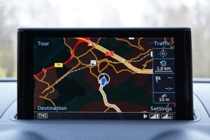
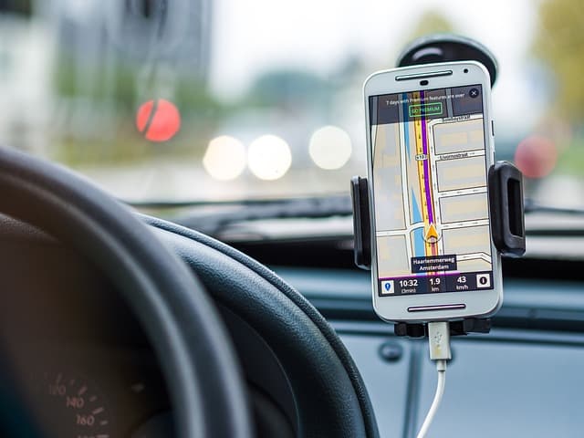
Satellite vehicle monitoring is a system of satellite monitoring and control of moving objects, based on the use of modern satellite navigation systems (GLONASS and GPS), communication equipment and technology (GSM WiFi), computer technology and digital maps.
The vehicle is equipped with an onboard controller (tracker), which includes a multichannel GLONASS/GPS navigation receiver and a GSM-modem with antennas. The navigation receiver receives signals emitted by GLONASS and GPS satellites and calculates its own coordinates. Calculated coordinates via GSM-cellular network are transmitted to the system server, where they are processed and transmitted to the dispatcher program for building reports and display location on the map. In addition to coordinates, the onboard controller can also transmit additional information about the state of connected sensors and modes of operation.

How does the transport satellite monitoring system work?

The implementation of the transport satellite monitoring system in the company's fleet can be divided into several stages:

Select the transport monitoring system and the option of its use;
Purchase the chosen system;
Assign a person responsible for the implementation and operation of the transport monitoring system among its employees;
Install the equipment on the monitored vehicles;
To instruct the drivers (it is desirable to conclude an agreement on material responsibility);
Install dispatching software;
Conduct training for dispatchers;
Continuous operation of the transport monitoring system.

What does it take to get a monitoring system up and running correctly?

Most of the modern satellite vehicle monitoring systems have similar technical indicators and differ primarily in the capabilities of the dispatcher software (user-friendly interface and informative reports), as well as the quality, reliability and set of additional functions of the onboard controller (tracker), the ability to connect additional sensors.

What can be the difference between different satellite vehicle monitoring systems?

Recent Updates

Our Latest News

mercedes-benz
Software Development for Unmanned Vehicles

Who would have guessed that an ordinary phone would one day get rid of wires and become an indispensable mobile assistant, capable of replacing a dozen different devices? Something similar is now happening to cars. It may not be too noticeable at the moment, but we are on the verge of an automotive revolution that will change the perception of the four-wheeled vehicle.

navigation
Navigation Systems: a Guide to Selecting GPS Navigation Systems

Navigation systems for cars today have become a matter of course for every self-respecting driver. If you live in a big city or often travel outside it, then GPS navigator for your car is a must – without it there is a high probability to make a wrong turn or at least spend extra time and gasoline. In addition, car navigators free you from the need to carry around bulky road maps, on which sometimes it is even impossible to determine your location.

Partnership

See the business results we deliver

IoT development services
https://kodjin.com/kodjin-fhir-server/
fitness app developers
PSD to WordPress
IT Outsource partner Boosty Labs
Blood Alcohol Concentration (BAC) Calculator
indoor navigation
make a dating app
Trinetix.com
call tracking service
payment software development